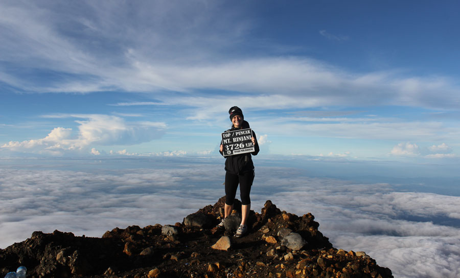
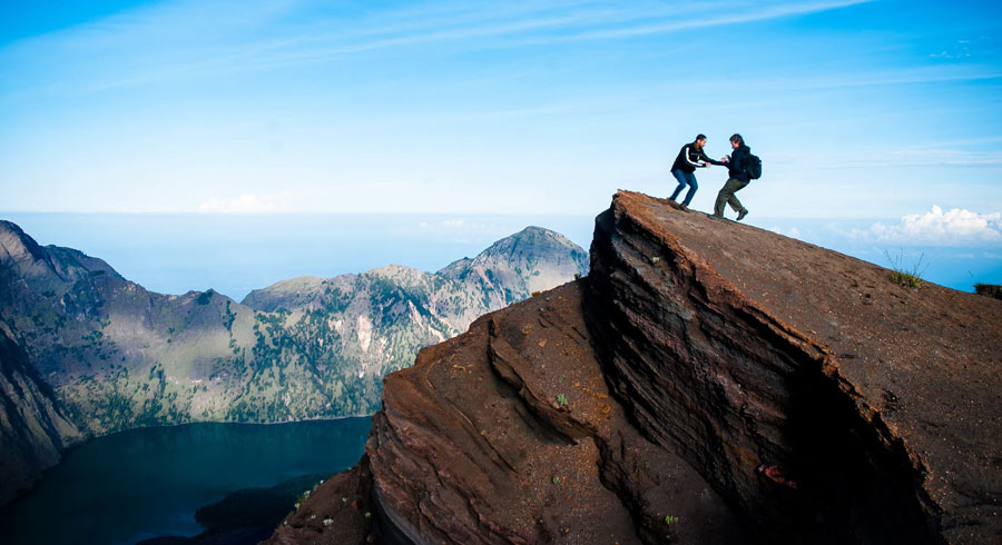
Summit Mount Rinjani 3726 meter
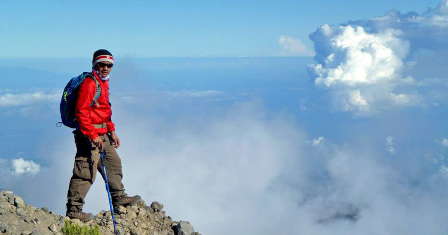
Summit Of Mount Rinjani 3726 meter
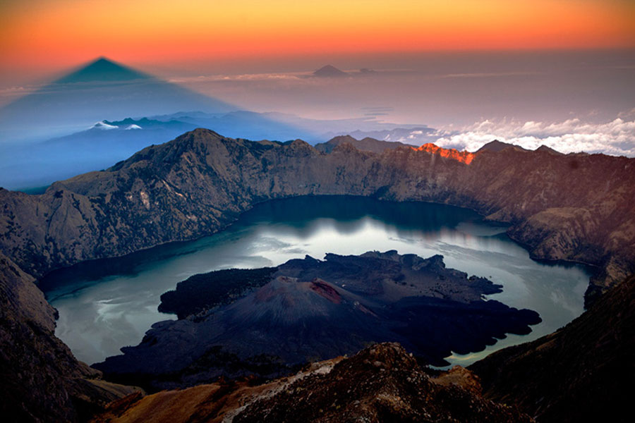
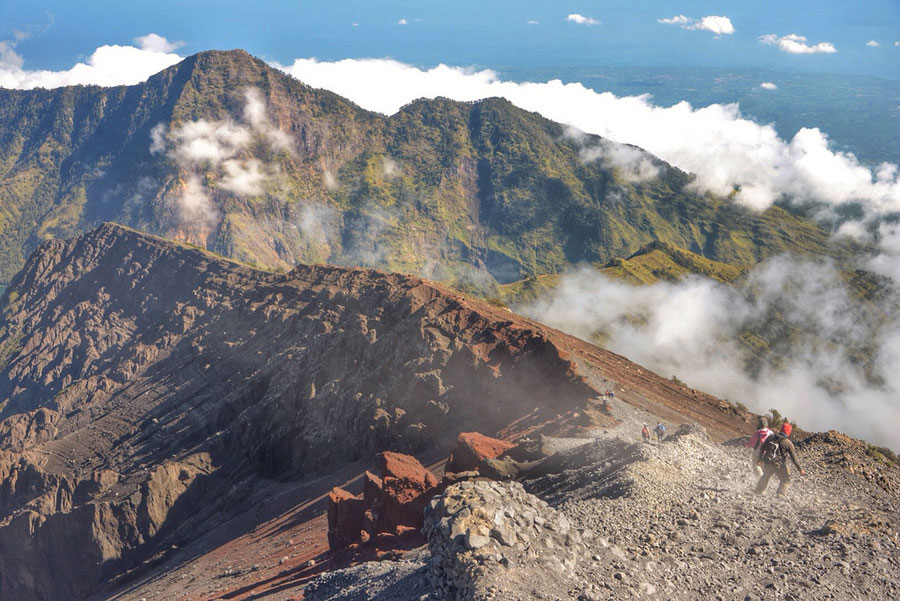
Mount Rinjani Peak 3726 meter above sea level or 12,224ft
Mount Rinjani with the highest point of 3,726 m above sea
level or 12,224ft, dominates most of the scenery of the northern part of Lombok
Island. To the west of the Rinjani cone there is a caldera with an area of approximately
3,500 m × 4,800 m, extending east and west.
On the eastern side of the caldera there is Mount Baru (or Mount Barujari) which
has a crater measuring 170m × 200 m with an altitude of 2,296 - 2376 masl. This
small mountain last erupted on 25 October 2015 and 3 November 2015, after previously
recorded erupting in May 2009 and in 2004. If the 2004 eruption did not cause
any casualties, the 2009 eruption had indirectly killed 31 people, due to flooding
on Tanggek river due to lava pressure to Segara Anak. Previously, Mount Barujari
had recorded erupting in 1944 (as well as its formation), 1966, and 1994.
Summit Mount Rinjani
Located on the island of Lombok in Indonesia, is an
awe-inspiring volcanic peak. Standing at 3,726 meters (12,224 feet)
above sea level, it's the second-highest volcano in Indonesia. The
trek to its summit is a challenging adventure that rewards you with
breathtaking views. Here's what you need to know:
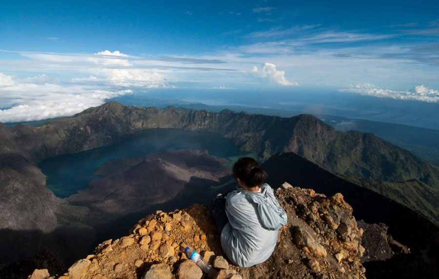
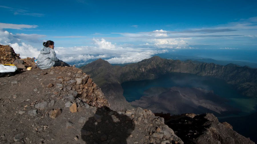
1. Why Trek Rinjani? The tough hike to the crater rim offers
magnificent vistas. Picture rocky black soil at the summit, dropping into a
lush valley with vibrant purples and greens. Lake Segara Anak, nestled in
the crater, is a deep turquoise, reflecting Lombok's seas. At night, the sky
is a canvas of stars. The trek is about pushing your limits and shouting,
"Hell yes, I did it!".
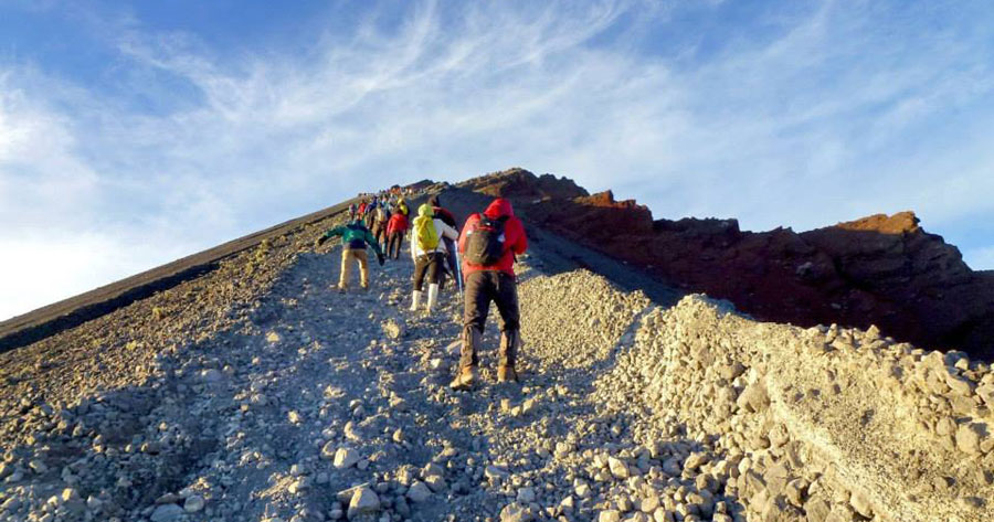
2. Trekking Options: Rinjani is usually climbed in two or three
days, depending on the route. The most direct route to the summit starts
from Sembalun village in East Lombok.
3. Challenges: Be prepared for a 1500-meter climb over 8
kilometers. It's harder than it sounds! The reward? Unforgettable
memories and a sense of accomplishment.
Here's what you need to know if you're considering a trek to its summit
1. Trek Difficulty: A Mount Rinjani trek is not
for novice hikers. It's a challenging 3-day journey to the summit of the
second-highest volcano in Indonesia. The trek starts with a climb of 1500
meters over 8 kilometers.
2. Why Trek Rinjani?: The tough hike to the crater rim rewards you
with magnificent views. Rocky black soil at the summit drops off into a lush
valley filled with vibrant purples and greens. Lake Segara Anak, nestled in
the crater, is a deep turquoise. At night, the sky is blanketed with stars.
The most compelling reason to trek Rinjani? To challenge your body and mind
and shout, "Hell yes, I did it!"
3. Best Time to Hike: The dry season, from April to October, is
ideal. Aim for April to May or September to October for the most enjoyable
experience.
4. Trekking Options: You can choose between a 2-day hike (requires
good fitness level), a 3-day trek to the crater rim and lake, or a more
relaxing 4-day hike.
5. Starting Points: Two common starting points are Sembalun (East
Lombok) and Senaru. Sembalun offers a more direct route to the summit, while
Senaru provides access to the crater rim and lake.
6. Accommodation and Food: Accommodations are basic, and food is
provided by your trekking service. Be prepared for rustic conditions.
7. We are tour operators: We are tour operator a reputable that
includes experienced guides, porters, and safety measures.
8. Packing List: Essential items include proper hiking gear, warm
clothing, a headlamp, and a sense of adventure!
Remember, the challenge of Rinjani is part of its allure, If you're up
for it, this trek promises unforgettable experiences and stunning vistas!
This adventure isn't for beginner hikers, but if you're up for it, the
views and experience are worth every step!
Mount Rinjani summit temperature
When trekking to the summit of Mount Rinjani, the
temperatures can vary significantly based on the altitude.
Here's what you can expect:
1. Lower Altitudes (Below 2,000 meters / 6,561.68 feet):
- Daytime temperatures: Around 23°C to 26°C (73.4°F to 78.8°F).
- Nighttime temperatures at the base camp: Usually below 10°C (50°F).
- Nights can be extremely cold, especially as you ascend.
2. Higher Altitudes (Above 2,000 meters):
- As you climb higher, temperatures drop further.
- Near the summit, it can even reach freezing levels.
Remember to dress in layers and be prepared for the chilly conditions
during your trek!
For more details
Mount Rinjani summit temperature, you can check out this Enjoy your
adventure!
Your guide and porter have brought camera as your memories at summit Mount Rinjani here and please visit again photo galleries of all our guests at the facebook page during a hike on Mount Rinjani at www.facebook.com/climbingrinjani/
View Google Maps 360° Summit of Mount Rinjani 3,726
meter above sea level
Peak of Mount Rinjani an altitude 3726 meters
To go peak Mount Rinjani 3726 m altitude
By the time we got down, you trample eroded sand and slipped deep enough, carefully.. and do not run the time down from the summit of Mount Rinjani
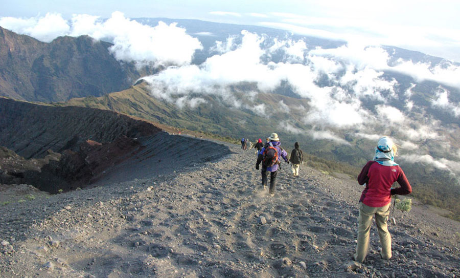
By the time we got down, you trample eroded sand and slipped deep enough, carefully.. and do not run the time down from the summit of Mount Rinjani
Rinjani Mountain Summit 3726 meters
Rinjani Mountain Summit 3726 meters
Before to go Summit Mt Rinjani
The above Trekking Route starting point from Senaru village to go Summit of Mount Rinjani altitude 3726 meters